It was a long wait.
I was scheduled to visit Black Island over a week ago, but the storms just kept coming. This has, in fact, been the stormiest October I have ever seen in McMurdo. One after another, storms bearing high winds and blowing snow rolled up from the south, essentially shutting everything down for weeks. But finally, a window of opportunity opened up, and a few of us boarded a helicopter for the 20-minute ride to Black Island.
Black Island is across the McMurdo Ice Shelf from Ross Island, where McMurdo Station is located. Its name derives from the fact that it is almost entirely bare, black, volcanic rock. This is curious, because right next to Black Island is White Island, which is almost entirely covered by snow and ice. To my knowledge, no one fully understands why two islands of nearly identical size so close to each other should be so dramatically different.
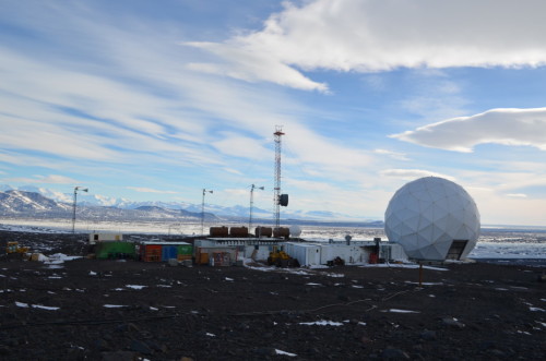
Black Island is important because it’s our communications link. Mount Erebus lies to the immediate north of McMurdo Station, so our view of equatorial communication satellites is blocked. Black Island, on the other hand, has a fairly clear view of those satellites, so we can have email, phone service, and most importantly, transfer of scientific data. I was going out to speak to the long-time camp manager, Tony Marchetti, in order to understand how the place operates.

Black Island Camp
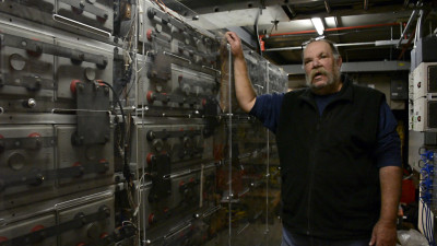
Tony is a very colorful character. If he was a sailor, people would be calling him an old salt. After 27 years in Antarctica, most of it on Black Island, he has a fair number of stories, most of which will leave you rolling on the floor laughing. If he ever wanted to, I’m certain Tony could be a stand-up comedian. But the really important thing about Tony is that he knows Black Island, with all it foibles and requirements and sophisticated electronics, better than anyone else.

Tony Marchetti (Photo by Peter Rejcek)
When we landed, the wind was blowing at about 25 knots, which was the slowest Tony had seen in over a week. Just a few days before my visit, he clocked winds at about 80 knots, which is a little over hurricane force. Shortly after my arrival, the wind started to pick up again, ratcheting up to 50 knots at one point. Helicopter pilots don’t like to land in that kind of wind, so it was beginning to look like I was going to be spending the night. I decided to go out and look around.
Walking around on rocky ground is interesting in 50-knot winds (about 57 mph). It is particularly challenging to try and shoot photos in those conditions, especially when it is gusty. I would brace myself for a shot, then the wind would let up a little and knock me off balance. By the time I rebalanced myself, the wind would pick up again and throw me in the other direction. It was like trying to take pictures while someone was holding on to my parka and shoving me randomly back and forth. There were times when the wind threatened to blow me over. Heading back to the camp, the wind caught my hood and it became a sail anchored at my neck. It felt like I was being choked.
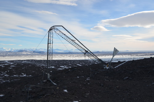
I came across another rather stark reminder of the wind’s power. There used to be four wind-powered generators at Black Island. This last winter, in a bit of irony, one of them was destroyed by the very wind it was supposed to harness. Since no one was there at the time, there is no way of knowing how hard the wind was blowing, but it seems unlikely it was less than 100 knots. The generator tower was bent nearly in two and the generator slammed into the ground by the force of the wind.

Wind generator destroyed by wind
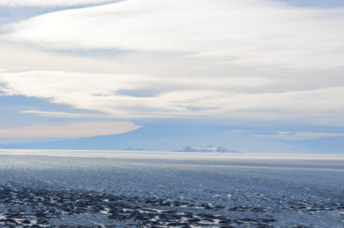
The photo below is looking toward Ross Island. The rocky knob is the end of Hut Point Peninsula, where McMurdo Station is located. The mountain with its top in the clouds is Mount Erebus, an active volcano. Much of the ice shelf between Black Island and Ross Island is called the “Dirty Ice,” because it is exactly that. It is glacial ice that has been coated over the millennia with wind-blown dirt. The dark dirt causes the surface of the ice to melt in the summer, which then re-freezes, over and over again, year after year, century after century. The result is ice characterized by high ridges and deep trenches. It is treacherous and essentially impossible to cross.

Ross Island from Black Island
It is hard to tell that the wind was howling when the photo was taken, but the clouds are an indication. Clouds with circular or lenticular shapes usually mean high winds. However, in the end the wind dropped to 35 knots, long enough for a helicopter to come out, pick me up, and bring me back to McMurdo. Hidden in my pocket were two bits of treasure: Black Island cookies, baked by Zack, the current Black Island cook. Best cookies in Antarctica. So far.


8 Responses to Black Island